Crowdsourcing geospatialized data
Looking up parking lots suitable for a solar farm?
Reporting potholes?
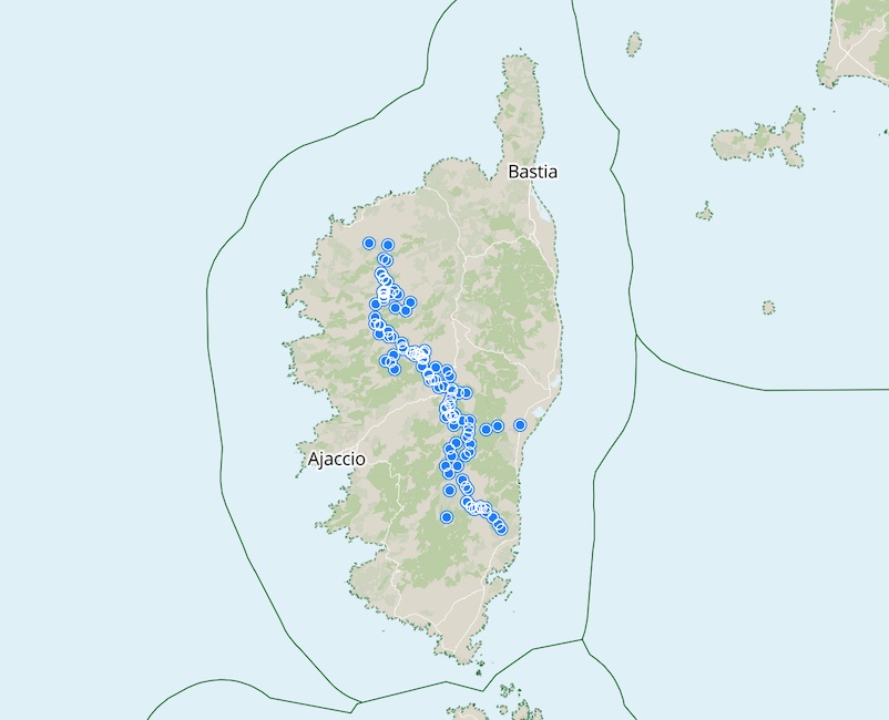
Maintaining hiking trail markers?
Easily done by relying on a team of contributors.
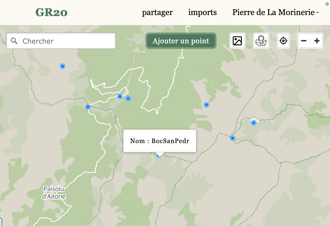
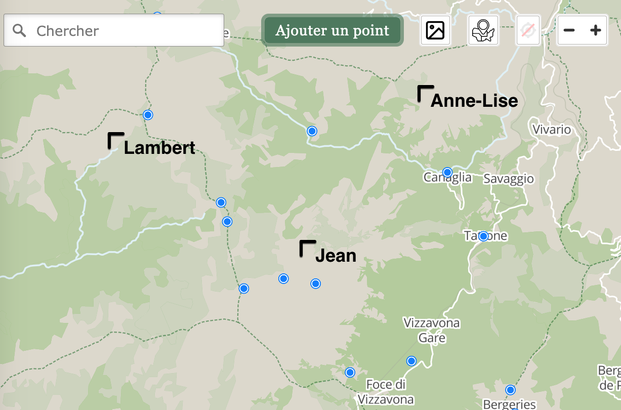
Add points
Add geographic features right from the map: create points, lines and polygons.
cocarto is a breeze to use, even by non-specialists.
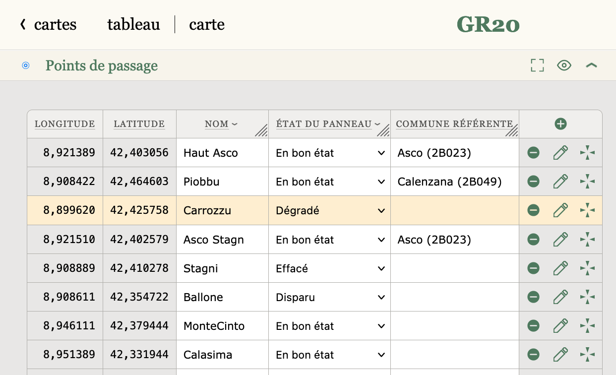
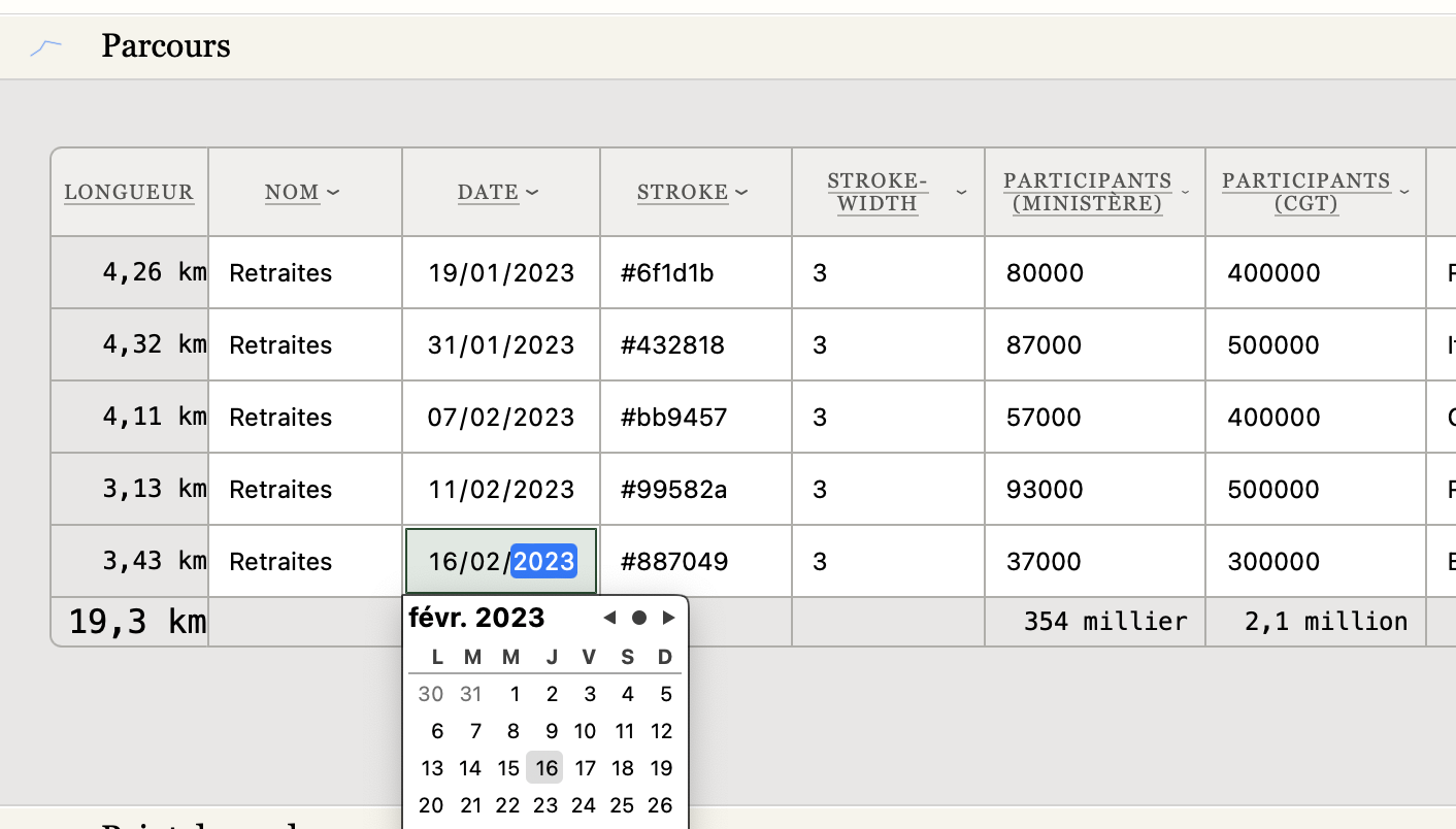
Track updates
Update your data right from the spreadsheet.
Sort, edit, add extra columns for additional data.
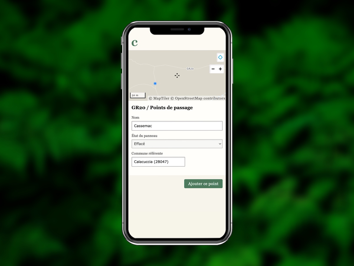
Add data from the field
Share a link to the mobile form. Now, just by opening the link, contributors from your team can add new geospatialized data.
Using the simplified mobile form, only new points can be added. You can later review and validate the additions.
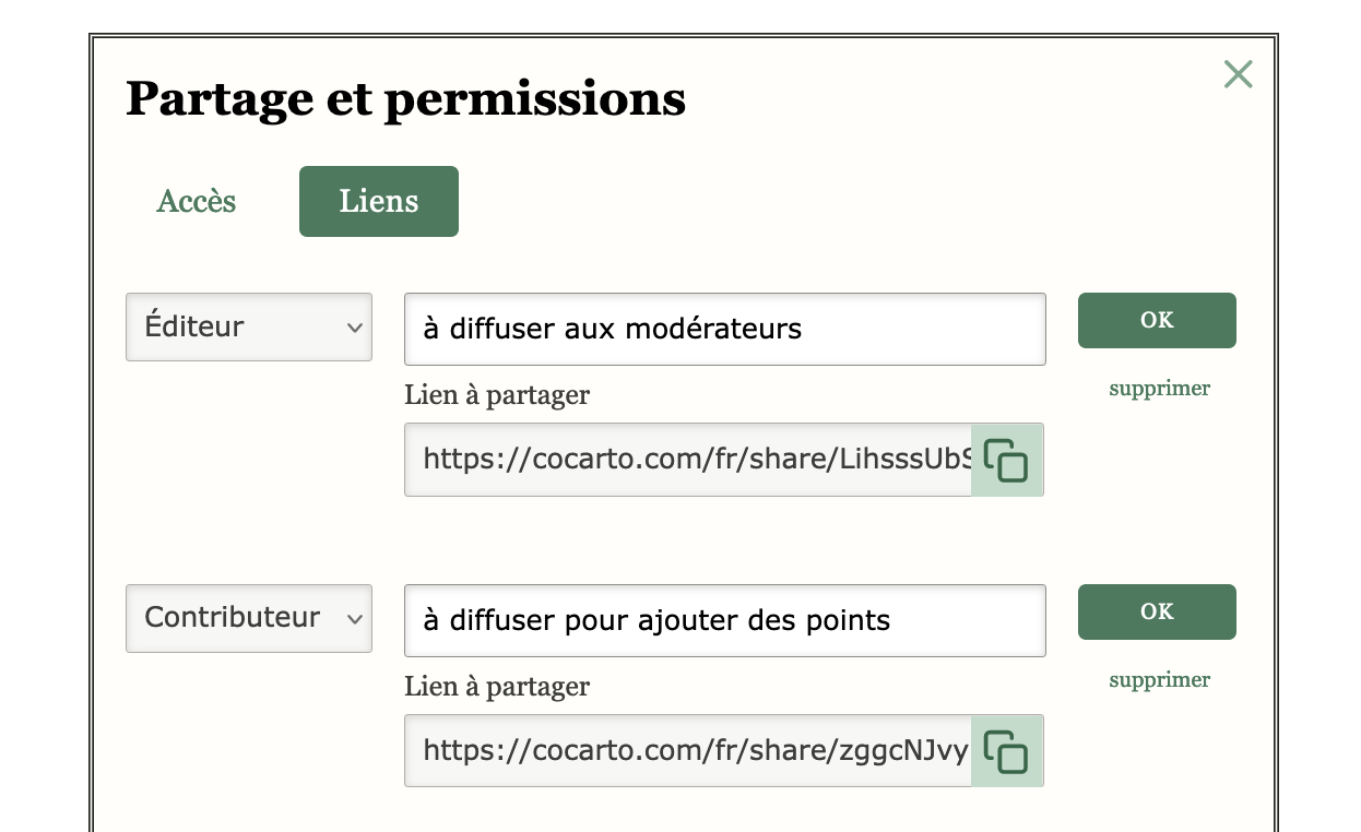
Share with a team of contributors
Invite external persons by email. They can either fully edit the data (Editor), or just add new data (Contributor).
To gather an even larger team, generate an invitation link, and share it widely.
Ensure the quality of your data
To make data entry easier, column types help you to constraint allowed values. Say goodbye to bad data or invalid zip codes.
With column locking, you can also protect a column from unexpected changes.
Real-time collaboration
Connect several contributors to the same map, and work together on your data: additions and edits will display in real-time.
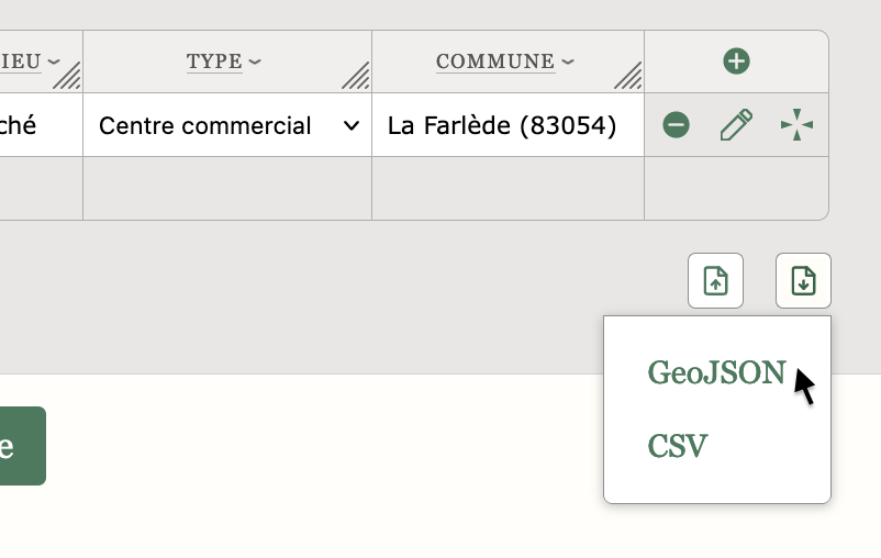
Re-export in your preferred format
A simple URL generates an export of your latest updates, as a CSV or geojson file. Handy to integrate your changes in another software downstream.